This research area explores various sensing-related problems as they relate to robotics. Some projects involved processing sensor data for the purposes of mapping and modeling. Others involved sensing as a means of controlling a robot or providing tracking information.

Honours Project Taronish Dastur

Creating 3D Models From a Stereo Camera

In this project, images from a stereo camera were used to develop a 3D model of an object. A depth map obtained from two images was used as the basis for the model. The project inviolved storing the image data, removing noise and connecting broken points. The model was then transformed into cube shaped blocks for integration with a Cube-shaped Robot simulation project. The resulting models formed by the project can be used for a variety of purposes including as a template for 3D printing, construction, etc..
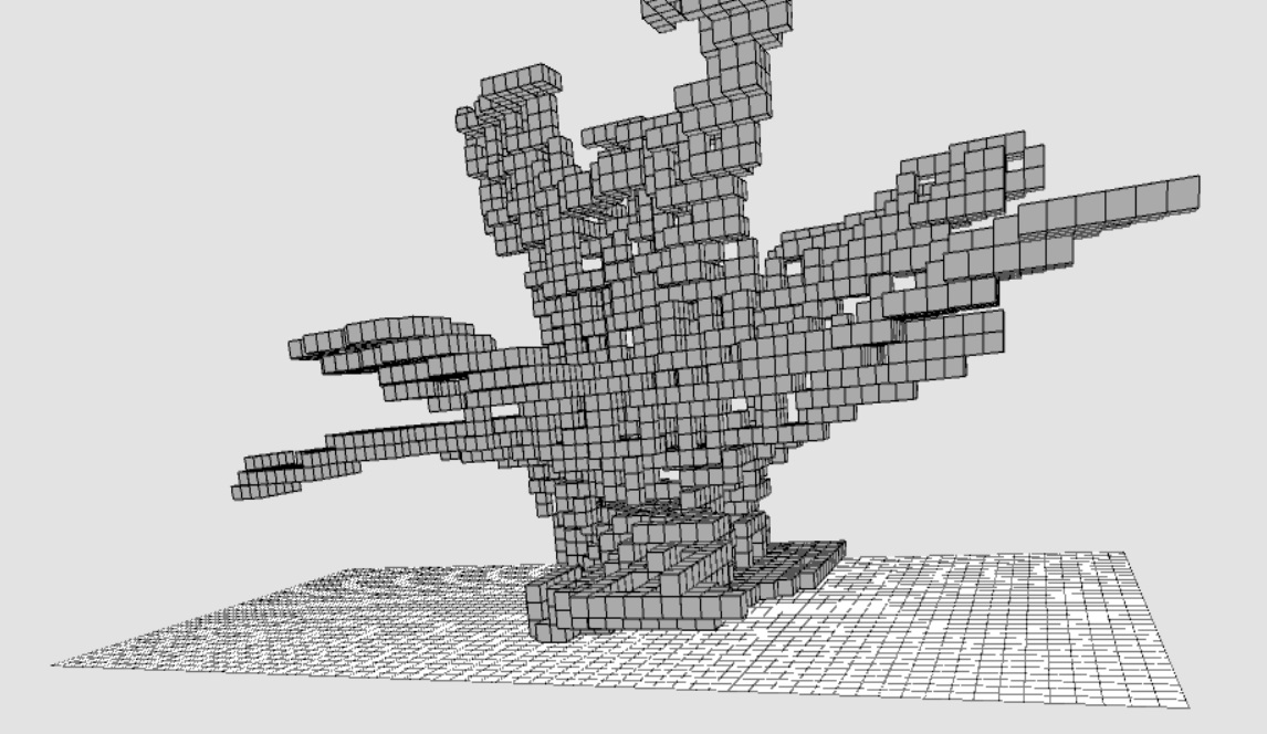
A model formed from stero cameras
Masters Thesis Sheng An

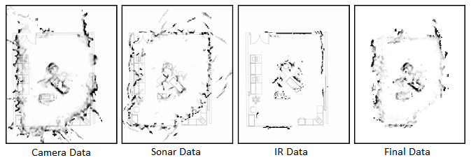
Improving Vision-Based Maps by Using Sonar and IR Sensor Fusion

Vision-based sensors such as stereo cameras, are often used on mobile robots for mapping and navigation purposes. Cameras provide a rich set of data making them useful for object recognition, localization and detecting environmental structure. When obtaining range measurements, however, stereo camera vision systems do not perform well under some environmental conditions such as featureless regions (e.g., blank walls), large metallic or glass surfaces (e.g., windows) and low lighting scenes. We have investigated the improvement of range data obtained from a stereo camera vision system through the fusion of additional sonar and infrared proximity sensor data. Our results showed that through sensor fusion, we were able to discard 49% of the camera data as noise and improved our perimeter mapping by filling in 12% of the perimeter which was missing from the camera data alone.

Maps produced via sensor fusion
Honours Project Wes Lawrence

Controlling Propbots With Microsoft Kinect

In this project, we investigated the idea of controlling a group of robots through simple gestures and voice commands. Such commands can suggest to robots how to act, or instruct them to perform particular tasks. For example, point to a location, and the robot goes there ... or speak a single robot's "name", and only that robot pays attention to you. In our implementation, a Microsoft kinect device was used to monitor the gestures and voice commands of a human operator. Certain gestures were recognized as commands to be sent to a group of robots to coordinate their movements and tasks. This project was done as a "proof-of-concept" where just a couple of robots were used (i.e., PropBots built by Mark Lanthier) and just a few gestures were incorporated.

Using kinnect to control a robot
Honours Project Joyce Tannouri

Wireless Robotic Imitation of Human Movements Using a Kinect

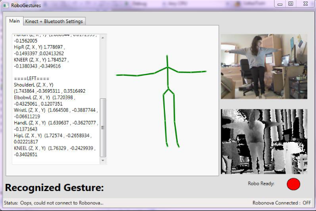
The main goal of this project was to get a Microsoft Kinect sensor to recognize user gestures, movements, and poses and then wirelessly have a ROBONOVA-I mimic them in real-time using Bluetooth technology. Given the ROBONOVA-I's limitations, using the Kinect's skeletal tracking and depth capabilities allows to program a wide range of recognizable gestures that can be performed by the robot. In the end, the robot was able to combine different gestures and positions together while maintaining balance and stability for a total of 50 movements.

Snapshot of interface that uses human movements to control a humanoid
Honours Project Mohammed Khoory

Scanning Objects in 3D With Kinect

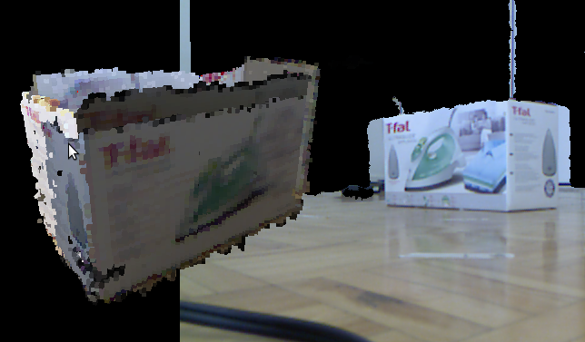
Robots often need to scan 3D environments to recognize landmarks and create 3D representations of what they see around them. In this project, we investigated the idea of scanning real-world objects with a Microsoft Kinect device and representing them as geometric voxel models. Different methods to help reduce the noise in the data were explored. By controlling the resolution of the voxels, the program was able to control the complexity and level of detail in the resulting model.

A Kinnect scan of a box
Honours project William Wilson

3D Mapping and Imaging

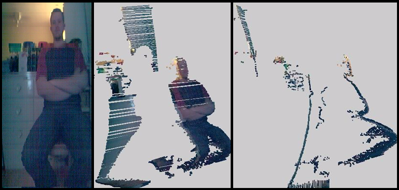
It is difficult to form accurate 3D models from simple 2D camera data. 3D laser scanners are can produce more accurate 3D models in terms of shape and size, but such scanners lack texture and color information. In this project we combined 2D camera image data with 3D laser scanner data to form 3D models of a scene.

3D Laser scan of a human
Honours project Sara Verkaik

Robot Tracker Improvements

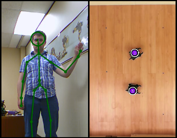
GPS systems give absolute positioning for outdoor vehicles, allowing a drivers to know where they are within their environment. However, in a small indoor environment, it is difficult to obtain absolute positioning for robots because GPS systems do not work indoors and would not provide adequate accuracy for robotic task completion. In our lab, we developed an overhead camera system to track robots based on recognizing various colored tags. However, a need arose to be able to distinguish more robots from one another, so a tag-based system had to be developed. This project investigated various types of tags and how they performed in regards to proper recognition from the overhead cameras.

Snapshot of tracking tags
Honours project Philip Carswell

3D Scale Depth Analysis

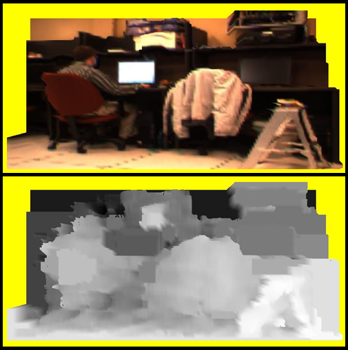
The pictures produced from a stereo camera may have inaccurate depth data due to lack of contrast. In this project, a "manual-fix" feature can be used to manually choose which pixels to fix, and at what depth. Because this process is impractical and time-consuming, two "automatic-fix" algorithms were created to fix the depth data. One is based on searching for the closest correct depth data to replace the faulty one, while the other averages depths surrounding the faulty pixel in an N by N area, which is specified as input to the algorithm.

Snapshot of depth scale for a scene
Honours project Jason Humber

Map Generation Ultrasonic and IR Sensory Data

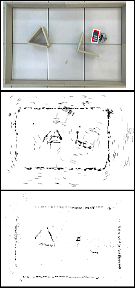
This project investigated the accuracy of maps that could be obtained by using a Sharp GP2D12 IR distance sensor and a MindSensors Ultrasonic Proximity Sensor mounted on a robot whose position was tracked by an overhead camera tracking system.

Map snapshots topdown view
Honours project Dwayne Moore

Spatial Cognition Using a Specialized Grid

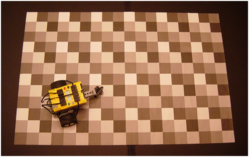
In this project we investigated the ability of a robot to keep track of its location within a grid environment through use of a simple light sensor under the robot. By using various shades of gray arranged in a pattern, the robot was able to maintain a fairly accurate estimate of its position by recognizing when it had moved from one grid cell to another.

Robot on a patterned grid
← Back to Research